
|
FP depiction on IFD540 |
Post Reply 
|
| Author | |
luchetto 
Senior Member 
Joined: 10 Dec 2015 Location: Switzerland Status: Offline Points: 119 |
 Post Options Post Options
") Thanks(0) Thanks(0)
 Quote Reply Quote Reply
 Topic: FP depiction on IFD540 Topic: FP depiction on IFD540Posted: 29 Mar 2016 at 9:21am |
|
|
 |
|
|
luchetto
Senior Member
Joined: 10 Dec 2015 Location: Switzerland Status: Offline Points: 119 |
Post Options
Thanks(0)
Quote Reply
Posted: 29 Mar 2016 at 9:22am |
|
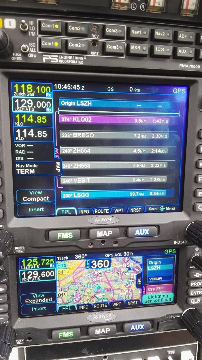
When I load a FP on the 540 the labels of the legs are always compact, no matter whether I hit the LSK key view compact or view expanded. Pls have a look at the pictures. Where could I change the look so that it is the same as on the 440, where the full info is shown?
|
|
|
|
|
oskrypuch
Senior Member
Joined: 09 Nov 2012 Location: CYFD Status: Offline Points: 3058 |
Post Options
Thanks(0)
Quote Reply
Posted: 29 Mar 2016 at 10:44am |
|
The compact/expanded refers to compacting airways and procedures to one data block.
The one vice three line flightplan datablocks is an option in the user settings. Handy for the 440, unnecessary for the 540. * Orest |
|
|
|
|
chflyer
Senior Member

Joined: 24 Jan 2013 Location: LSZK Status: Offline Points: 1022 |
Post Options
Thanks(0)
Quote Reply
Posted: 29 Mar 2016 at 12:54pm |
|
The 3-line flight plan data block format might be useful even on the 540 if it is desired to have the crossing altitudes and expected ETA shown on all the flight plan blocks in the list. However, any individual wpt can be toggled just by touching it and the crossing altitudes are on the map anyway, so mostly unnecessary as you indicate, Orest.
|
|
|
Vince
|
|
|
|
|
Post Reply
|
|
 Tweet
Tweet
|
| Forum Jump | Forum Permissions You cannot post new topics in this forum You cannot reply to topics in this forum You cannot delete your posts in this forum You cannot edit your posts in this forum You cannot create polls in this forum You cannot vote in polls in this forum |


 Topic Options